
Articles | Volume 23, issue 18
https://doi.org/10.5194/bg-23-6687-2026
© Author(s) 2026. This work is distributed under
the Creative Commons Attribution 4.0 License.
the Creative Commons Attribution 4.0 License.
https://doi.org/10.5194/bg-23-6687-2026
© Author(s) 2026. This work is distributed under
the Creative Commons Attribution 4.0 License.
the Creative Commons Attribution 4.0 License.
Research article
| 
23 Sep 2026
Research article |
| 23 Sep 2026
| 23 Sep 2026
Using deep learning to assimilate sun-induced fluorescence satellite observations in the ISBA land surface model
Pierre Vanderbecken
Météo-France, CNRS, Univ. Toulouse, CNRM, Toulouse, France
Jasmin Vural
Météo-France, CNRS, Univ. Toulouse, CNRM, Toulouse, France
Oscar Rojas-Muñoz
Météo-France, CNRS, Univ. Toulouse, CNRM, Toulouse, France
Sébastien Garrigues
ECMWF, Reading, UK and Bonn, Germany
Bertrand Bonan
Météo-France, CNRS, Univ. Toulouse, CNRM, Toulouse, France
Cédric Bacour
Laboratoire des Sciences du Climat et de l'Environnement, LSCE/IPSL, CEA-CNRS-UVSQ, Université Paris-Saclay, Gif-sur-Yvette, France
Uwe Rascher
Institute of Bio- and Geosciences, IBG-2: Plant Sciences, Forschungszentrum Jülich GmbH, Leo-Brandt-Str., 52425 Jülich, Germany
Bastian Siegmann
Institute of Bio- and Geosciences, IBG-2: Plant Sciences, Forschungszentrum Jülich GmbH, Leo-Brandt-Str., 52425 Jülich, Germany
Patricia de Rosnay
ECMWF, Reading, UK and Bonn, Germany
Jean-Christophe Calvet
CORRESPONDING AUTHOR

Météo-France, CNRS, Univ. Toulouse, CNRM, Toulouse, France
Related authors
Yann Baehr, Pierre Vanderbecken, Bertrand Bonan, Catherine Robert, Mathieu Regimbeau, François Pimont, Kevyn Raynal, Xiangzhuo Liu, Remi Savazzi, Moncef Garouani, Josiane Mothe, Nemesio Rodriguez-Fernandez, Lionel Jarlan, and Jean-Christophe Calvet
EGUsphere, https://doi.org/10.5194/egusphere-2026-1247, https://doi.org/10.5194/egusphere-2026-1247, 2026
This preprint is open for discussion and under review for Natural Hazards and Earth System Sciences (NHESS).
Short summary
Short summary
This study produced vegetation water content maps to help manage the risk of forest fires in France. Artificial intelligence was used alongside land surface model outputs, satellite data and in situ observations to monitor vegetation stress in real time. The methodology tested has been shown to be robust and spatially consistent.
Jasmin Vural, Pierre Vanderbecken, Bertrand Bonan, Oscar Rojas-Munoz, and Jean-Christophe Calvet
EGUsphere, https://doi.org/10.5194/egusphere-2026-838, https://doi.org/10.5194/egusphere-2026-838, 2026
Short summary
Short summary
New satellite observations are used to improve our understanding of agricultural land on a global scale. Innovative artificial intelligence methods are employed to combine the available information. This improvement is evaluated using independent observations and varies depending on the characteristics of instruments and models.
Joffrey Dumont Le Brazidec, Pierre Vanderbecken, Alban Farchi, Grégoire Broquet, Gerrit Kuhlmann, and Marc Bocquet
Geosci. Model Dev., 18, 3607–3622, https://doi.org/10.5194/gmd-18-3607-2025, https://doi.org/10.5194/gmd-18-3607-2025, 2025
Short summary
Short summary
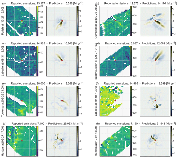
We developed a deep learning method to estimate CO2 emissions from power plants using satellite images. Trained and validated on simulated data, our model accurately predicts emissions despite challenges like cloud cover. When applied to real OCO3 satellite images, the results closely match reported emissions. This study shows that neural networks trained on simulations can effectively analyse real satellite data, offering a new way to monitor CO2 emissions from space.
Marc Bocquet, Pierre J. Vanderbecken, Alban Farchi, Joffrey Dumont Le Brazidec, and Yelva Roustan
Nonlin. Processes Geophys., 31, 335–357, https://doi.org/10.5194/npg-31-335-2024, https://doi.org/10.5194/npg-31-335-2024, 2024
Short summary
Short summary
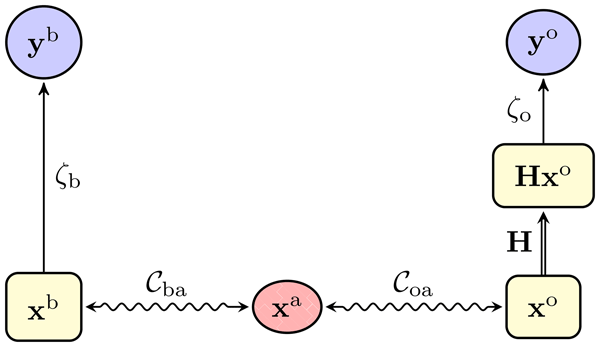
A novel approach, optimal transport data assimilation (OTDA), is introduced to merge DA and OT concepts. By leveraging OT's displacement interpolation in space, it minimises mislocation errors within DA applied to physical fields, such as water vapour, hydrometeors, and chemical species. Its richness and flexibility are showcased through one- and two-dimensional illustrations.
Roberto Colombo, Béatrice Berthelot, Alireza Mahmoodi, Louis Sainte-Marie, Gwennaël Matot, Jorge Vicent Servera, Ornela Nanushi, Brice Mora, Mohamed Salah Djellali, Neus Sabater, Pekka Kolmonen, Timo H. Virtanen, Astrid M. Zimmermann, Pieter De Vis, Micol Rossini, Giulia Tagliabue, Pietro Chierichetti, Sergio Cogliati, Juliane Bendig, Bastian Siegmann, Uwe Rascher, Egor Prikaziuk, Christiaan van der Tol, Darren Ghent, Jasdeep Singh Anand, Tommaso Julitta, Matthias Drusch, Marco Celesti, Dirk Schüttemeyer, and Marin Tudoroiu
Int. Arch. Photogramm. Remote Sens. Spatial Inf. Sci., XLVIII-M-12-2026, 17–24, https://doi.org/10.5194/isprs-archives-XLVIII-M-12-2026-17-2026, https://doi.org/10.5194/isprs-archives-XLVIII-M-12-2026-17-2026, 2026
Ekaterina Vorobeva, Yvan Orsolini, Patricia de Rosnay, Jonathan Day, Retish Senan, Damien Decremer, and Frederic Vitart
The Cryosphere, 20, 4605–4618, https://doi.org/10.5194/tc-20-4605-2026, https://doi.org/10.5194/tc-20-4605-2026, 2026
Short summary
Short summary
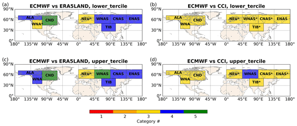
How reliable are probabilistic seasonal snow forecasts in winter? Although they are routinely issued by operational prediction centres, their reliability has never been evaluated. We close this gap by analyzing 30 years of seasonal snow re-forecasts and evaluating them against two snow datasets. Our results provide comprehensive assessment of seasonal snow forecast reliability and offer new insights into their performance in different parts of the Northern Hemisphere.
Oscar Rojas-Munoz, Constantin Ardilouze, Bertrand Bonan, Diane Tzanos, Darren Ghent, Céline Lamarche, Thomas Nagler, and Jean-Christophe Calvet
The Cryosphere, 20, 4099–4115, https://doi.org/10.5194/tc-20-4099-2026, https://doi.org/10.5194/tc-20-4099-2026, 2026
Short summary
Short summary
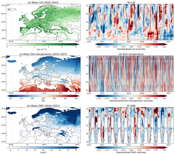
This study evaluated how updating land cover maps, such as forests, grasslands, and croplands, affects simulations of snow and land surface temperatures across Europe from 2010 to 2022. Results using older, less detailed maps were compared with those from newer, high-resolution data. The updated maps improved the accuracy of snow predictions, particularly in areas where grasslands transitioned to forests. However, the improvements were less noticeable for temperature simulations.
Nina Raoult, Ewan Pinnington, Mario Santa Cruz, Florian Pinault, Baudouin Raoult, Natalie Zelenka, Gabriele Arduini, Gianpaolo Balsamo, Souhail Boussetta, Matthew Chantry, Patricia de Rosnay, Peter Dueben, and Christoph Rüdiger
EGUsphere, https://doi.org/10.5194/egusphere-2026-3620, https://doi.org/10.5194/egusphere-2026-3620, 2026
Short summary
Short summary
The land surface shapes our weather and climate by controlling how heat and water move between the ground and the air, so the models representing it matter enormously. But they are costly to run and carry built-in errors. We built a faster artificial-intelligence version of one, then used real measurements from sites worldwide to correct some of these errors. The result stays reliable over years and better captures these heat and water exchanges—a quicker, more accurate tool for forecasting.
Gabriel Moldovan, Ewan Pinnington, Ana Prieto Nemesio, Simon Lang, Zied Ben Bouallègue, Jesper Dramsch, Mihai Alexe, Mario Santa Cruz, Sara Hahner, Harrison Cook, Helen Theissen, Mariana Clare, Cathal O'Brien, Jan Polster, Linus Magnusson, Gert Mertes, Florian Pinault, Baudouin Raoult, Patricia de Rosnay, Richard Forbes, and Matthew Chantry
Geosci. Model Dev., 19, 4703–4724, https://doi.org/10.5194/gmd-19-4703-2026, https://doi.org/10.5194/gmd-19-4703-2026, 2026
Short summary
Short summary
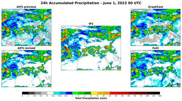
We present the latest release of the Artificial Intelligence Forecasting System, AIFS 1.1.0, which shows improved headline forecasting skill through an expanded dataset and enhanced training schedule. The model also incorporates hard physical constraints that facilitate training and improve rainfall prediction. Finally, we extend the set of forecasted variables to include soil conditions and energy-related fields, strengthening the operational value of AIFS.
Paul D. Hamer, Miha Markelj, Oscar Rojas-Munoz, Bertrand Bonan, Jean-Christophe Calvet, Virginie Marécal, Alex Guenther, Heidi Trimmel, Islen Vallejo, Sabine Eckhardt, Gabriela Sousa Santos, Katerina Sindelarova, David Simpson, Norbert Schmidbauer, Heidi Hellén, Pascal Rubli, Stefan Reimann, Anja Claude, Dagmar Kubistin, Julie Cozic, James Dernie, and Leonor Tarrasón
Earth Syst. Sci. Data, 18, 3635–3669, https://doi.org/10.5194/essd-18-3635-2026, https://doi.org/10.5194/essd-18-3635-2026, 2026
Short summary
Short summary
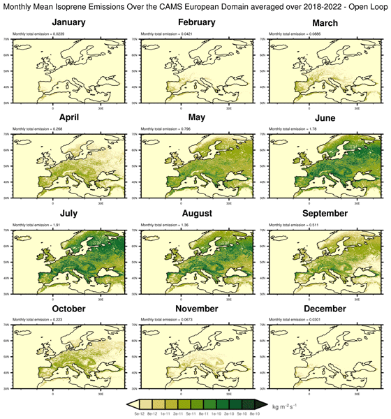
Plants release gases like isoprene that can form ozone and affect air quality. Using models and satellite data, we mapped the emissions of isoprene from plants across Europe and found that droughts can reduce leaf growth, leading to lower emissions. This shows that to understand and predict air quality, we must also understand how drought impacts vegetation. Our findings highlight the value of linking extreme weather, plant health, and pollution in models of the Earth system as a whole.
Yann Baehr, Pierre Vanderbecken, Bertrand Bonan, Catherine Robert, Mathieu Regimbeau, François Pimont, Kevyn Raynal, Xiangzhuo Liu, Remi Savazzi, Moncef Garouani, Josiane Mothe, Nemesio Rodriguez-Fernandez, Lionel Jarlan, and Jean-Christophe Calvet
EGUsphere, https://doi.org/10.5194/egusphere-2026-1247, https://doi.org/10.5194/egusphere-2026-1247, 2026
This preprint is open for discussion and under review for Natural Hazards and Earth System Sciences (NHESS).
Short summary
Short summary
This study produced vegetation water content maps to help manage the risk of forest fires in France. Artificial intelligence was used alongside land surface model outputs, satellite data and in situ observations to monitor vegetation stress in real time. The methodology tested has been shown to be robust and spatially consistent.
Jasmin Vural, Pierre Vanderbecken, Bertrand Bonan, Oscar Rojas-Munoz, and Jean-Christophe Calvet
EGUsphere, https://doi.org/10.5194/egusphere-2026-838, https://doi.org/10.5194/egusphere-2026-838, 2026
Short summary
Short summary
New satellite observations are used to improve our understanding of agricultural land on a global scale. Innovative artificial intelligence methods are employed to combine the available information. This improvement is evaluated using independent observations and varies depending on the characteristics of instruments and models.
Simon Beylat, Nina Raoult, Cédric Bacour, Natalie Douglas, Tristan Quaife, Vladislav Bastrikov, Peter J. Rayner, and Philippe Peylin
Geosci. Model Dev., 18, 7501–7527, https://doi.org/10.5194/gmd-18-7501-2025, https://doi.org/10.5194/gmd-18-7501-2025, 2025
Short summary
Short summary
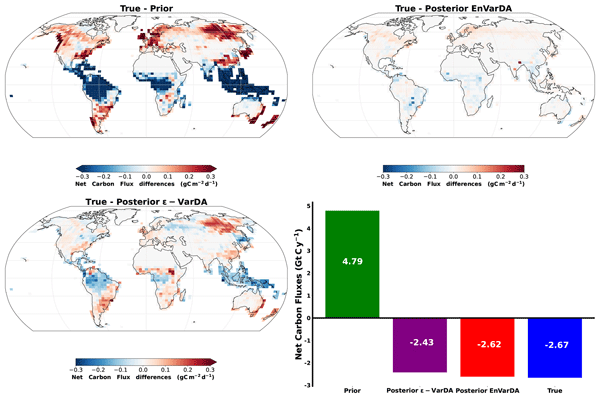
Land surface models are important tools for understanding and predicting the land components of the carbon cycle. Atmospheric CO2 concentration data are a valuable source of information that can be used to improve the accuracy of these models. In this study, we present a statistical ensemble-variational data assimilation method named EnVarDA to calibrate parameters of a land surface model using these data. We show that this method is easy to implement and more efficient and accurate than traditional methods.
Aurélien Mirebeau, Cécile de Munck, Bertrand Bonan, Christine Delire, Aude Lemonsu, Valéry Masson, and Stephan Weber
Geosci. Model Dev., 18, 5329–5349, https://doi.org/10.5194/gmd-18-5329-2025, https://doi.org/10.5194/gmd-18-5329-2025, 2025
Short summary
Short summary
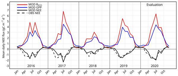
The greening of cities is recommended to limit the effects of climate change. In particular, green roofs can provide numerous environmental benefits, such as urban cooling, water retention, and carbon sequestration. The aim of this research is to develop a new module for calculating green roof CO2 fluxes within a model that can already simulate hydrological and thermal processes of such roofs. The calibration and evaluation of this module take advantage of long-term experimental data.
Jiaojiao Tian, Daniel Panangian, Wen Fan, Bastian Siegmann, and Xiangtian Yuan
ISPRS Ann. Photogramm. Remote Sens. Spatial Inf. Sci., X-G-2025, 885–892, https://doi.org/10.5194/isprs-annals-X-G-2025-885-2025, https://doi.org/10.5194/isprs-annals-X-G-2025-885-2025, 2025
Joffrey Dumont Le Brazidec, Pierre Vanderbecken, Alban Farchi, Grégoire Broquet, Gerrit Kuhlmann, and Marc Bocquet
Geosci. Model Dev., 18, 3607–3622, https://doi.org/10.5194/gmd-18-3607-2025, https://doi.org/10.5194/gmd-18-3607-2025, 2025
Short summary
Short summary
We developed a deep learning method to estimate CO2 emissions from power plants using satellite images. Trained and validated on simulated data, our model accurately predicts emissions despite challenges like cloud cover. When applied to real OCO3 satellite images, the results closely match reported emissions. This study shows that neural networks trained on simulations can effectively analyse real satellite data, offering a new way to monitor CO2 emissions from space.
Sophie Barthelemy, Bertrand Bonan, Miquel Tomas-Burguera, Gilles Grandjean, Séverine Bernardie, Jean-Philippe Naulin, Patrick Le Moigne, Aaron Boone, and Jean-Christophe Calvet
Hydrol. Earth Syst. Sci., 29, 2321–2337, https://doi.org/10.5194/hess-29-2321-2025, https://doi.org/10.5194/hess-29-2321-2025, 2025
Short summary
Short summary
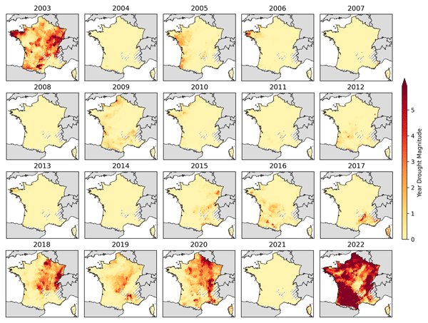
A drought index is developed that quantifies drought on an annual scale, making it applicable to monitoring clay shrinkage damage to buildings. A comparison with the number of insurance claims for subsidence shows that the presence of trees near individual houses must be taken into account. Significant soil moisture droughts occurred in France in 2003, 2018, 2019, 2020, and 2022. Particularly high index values are observed in 2022. It is found that droughts will become more severe in the future.
Gab Abramowitz, Anna Ukkola, Sanaa Hobeichi, Jon Cranko Page, Mathew Lipson, Martin G. De Kauwe, Samuel Green, Claire Brenner, Jonathan Frame, Grey Nearing, Martyn Clark, Martin Best, Peter Anthoni, Gabriele Arduini, Souhail Boussetta, Silvia Caldararu, Kyeungwoo Cho, Matthias Cuntz, David Fairbairn, Craig R. Ferguson, Hyungjun Kim, Yeonjoo Kim, Jürgen Knauer, David Lawrence, Xiangzhong Luo, Sergey Malyshev, Tomoko Nitta, Jerome Ogee, Keith Oleson, Catherine Ottlé, Phillipe Peylin, Patricia de Rosnay, Heather Rumbold, Bob Su, Nicolas Vuichard, Anthony P. Walker, Xiaoni Wang-Faivre, Yunfei Wang, and Yijian Zeng
Biogeosciences, 21, 5517–5538, https://doi.org/10.5194/bg-21-5517-2024, https://doi.org/10.5194/bg-21-5517-2024, 2024
Short summary
Short summary
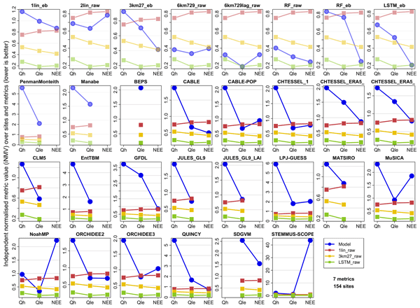
This paper evaluates land models – computer-based models that simulate ecosystem dynamics; land carbon, water, and energy cycles; and the role of land in the climate system. It uses machine learning and AI approaches to show that, despite the complexity of land models, they do not perform nearly as well as they could given the amount of information they are provided with about the prediction problem.
Henk Eskes, Athanasios Tsikerdekis, Melanie Ades, Mihai Alexe, Anna Carlin Benedictow, Yasmine Bennouna, Lewis Blake, Idir Bouarar, Simon Chabrillat, Richard Engelen, Quentin Errera, Johannes Flemming, Sebastien Garrigues, Jan Griesfeller, Vincent Huijnen, Luka Ilić, Antje Inness, John Kapsomenakis, Zak Kipling, Bavo Langerock, Augustin Mortier, Mark Parrington, Isabelle Pison, Mikko Pitkänen, Samuel Remy, Andreas Richter, Anja Schoenhardt, Michael Schulz, Valerie Thouret, Thorsten Warneke, Christos Zerefos, and Vincent-Henri Peuch
Atmos. Chem. Phys., 24, 9475–9514, https://doi.org/10.5194/acp-24-9475-2024, https://doi.org/10.5194/acp-24-9475-2024, 2024
Short summary
Short summary
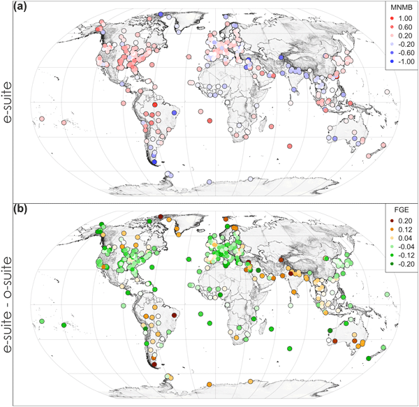
The Copernicus Atmosphere Monitoring Service (CAMS) provides global analyses and forecasts of aerosols and trace gases in the atmosphere. On 27 June 2023 a major upgrade, Cy48R1, became operational. Comparisons with in situ, surface remote sensing, aircraft, and balloon and satellite observations show that the new CAMS system is a significant improvement. The results quantify the skill of CAMS to forecast impactful events, such as wildfires, dust storms and air pollution peaks.
Marc Bocquet, Pierre J. Vanderbecken, Alban Farchi, Joffrey Dumont Le Brazidec, and Yelva Roustan
Nonlin. Processes Geophys., 31, 335–357, https://doi.org/10.5194/npg-31-335-2024, https://doi.org/10.5194/npg-31-335-2024, 2024
Short summary
Short summary
A novel approach, optimal transport data assimilation (OTDA), is introduced to merge DA and OT concepts. By leveraging OT's displacement interpolation in space, it minimises mislocation errors within DA applied to physical fields, such as water vapour, hydrometeors, and chemical species. Its richness and flexibility are showcased through one- and two-dimensional illustrations.
En Liu, Yonghua Zhu, Jean-Christophe Calvet, Haishen Lü, Bertrand Bonan, Jingyao Zheng, Qiqi Gou, Xiaoyi Wang, Zhenzhou Ding, Haiting Xu, Ying Pan, and Tingxing Chen
Hydrol. Earth Syst. Sci., 28, 2375–2400, https://doi.org/10.5194/hess-28-2375-2024, https://doi.org/10.5194/hess-28-2375-2024, 2024
Short summary
Short summary
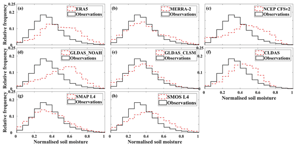
Overestimated root zone soil moisture (RZSM) based on land surface models (LSMs) is attributed to overestimated precipitation and an underestimated ratio of transpiration to total evapotranspiration and performs better in the wet season. Underestimated SMOS L3 surface SM triggers the underestimated SMOS L4 RZSM, which performs better in the dry season due to the attenuated radiation in the wet season. LSMs should reduce and increase the frequency of wet and dry soil moisture, respectively.
Sophie Barthelemy, Bertrand Bonan, Jean-Christophe Calvet, Gilles Grandjean, David Moncoulon, Dorothée Kapsambelis, and Séverine Bernardie
Nat. Hazards Earth Syst. Sci., 24, 999–1016, https://doi.org/10.5194/nhess-24-999-2024, https://doi.org/10.5194/nhess-24-999-2024, 2024
Short summary
Short summary
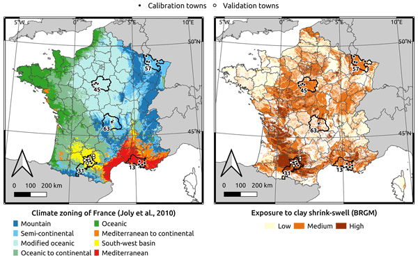
This work presents a drought index specifically adapted to subsidence, a seasonal phenomenon of soil shrinkage that occurs frequently in France and damages buildings. The index is computed from land surface model simulations and evaluated by a rank correlation test with insurance data. With its optimal configuration, the index is able to identify years of both zero and significant loss.
Sebastien Garrigues, Melanie Ades, Samuel Remy, Johannes Flemming, Zak Kipling, Istvan Laszlo, Mark Parrington, Antje Inness, Roberto Ribas, Luke Jones, Richard Engelen, and Vincent-Henri Peuch
Atmos. Chem. Phys., 23, 10473–10487, https://doi.org/10.5194/acp-23-10473-2023, https://doi.org/10.5194/acp-23-10473-2023, 2023
Short summary
Short summary
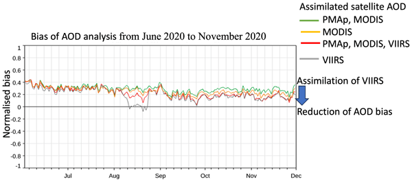
The Copernicus Atmosphere Monitoring Service (CAMS) provides global monitoring of aerosols using the ECMWF forecast model constrained by the assimilation of satellite aerosol optical depth (AOD). This work aims at evaluating the assimilation of the NOAA VIIRS AOD product in the ECMWF model. It shows that the introduction of VIIRS in the CAMS data assimilation system enhances the accuracy of the aerosol analysis, particularly over Europe and desert and maritime sites.
Anna Agustí-Panareda, Jérôme Barré, Sébastien Massart, Antje Inness, Ilse Aben, Melanie Ades, Bianca C. Baier, Gianpaolo Balsamo, Tobias Borsdorff, Nicolas Bousserez, Souhail Boussetta, Michael Buchwitz, Luca Cantarello, Cyril Crevoisier, Richard Engelen, Henk Eskes, Johannes Flemming, Sébastien Garrigues, Otto Hasekamp, Vincent Huijnen, Luke Jones, Zak Kipling, Bavo Langerock, Joe McNorton, Nicolas Meilhac, Stefan Noël, Mark Parrington, Vincent-Henri Peuch, Michel Ramonet, Miha Razinger, Maximilian Reuter, Roberto Ribas, Martin Suttie, Colm Sweeney, Jérôme Tarniewicz, and Lianghai Wu
Atmos. Chem. Phys., 23, 3829–3859, https://doi.org/10.5194/acp-23-3829-2023, https://doi.org/10.5194/acp-23-3829-2023, 2023
Short summary
Short summary
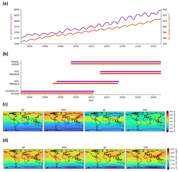
We present a global dataset of atmospheric CO2 and CH4, the two most important human-made greenhouse gases, which covers almost 2 decades (2003–2020). It is produced by combining satellite data of CO2 and CH4 with a weather and air composition prediction model, and it has been carefully evaluated against independent observations to ensure validity and point out deficiencies to the user. This dataset can be used for scientific studies in the field of climate change and the global carbon cycle.

Cédric Bacour, Natasha MacBean, Frédéric Chevallier, Sébastien Léonard, Ernest N. Koffi, and Philippe Peylin
Biogeosciences, 20, 1089–1111, https://doi.org/10.5194/bg-20-1089-2023, https://doi.org/10.5194/bg-20-1089-2023, 2023
Short summary
Short summary
The impact of assimilating different dataset combinations on regional to global-scale C budgets is explored with the ORCHIDEE model. Assimilating simultaneously multiple datasets is preferable to optimize the values of the model parameters and avoid model overfitting. The challenges in constraining soil C disequilibrium using atmospheric CO2 data are highlighted for an accurate prediction of the land sink distribution.
En Liu, Yonghua Zhu, Jean-christophe Calvet, Haishen Lü, Bertrand Bonan, Jingyao Zheng, Qiqi Gou, Xiaoyi Wang, Zhenzhou Ding, Haiting Xu, Ying Pan, and Tingxing Chen
Hydrol. Earth Syst. Sci. Discuss., https://doi.org/10.5194/hess-2023-33, https://doi.org/10.5194/hess-2023-33, 2023
Manuscript not accepted for further review
Short summary
Short summary
Among the 8 considered products, GLDAS_CLSM product performs best. All RZSM products overestimate the in situ measurements which attributes to a wet bias of air temperature, precipitation amount and frequency except the underestimation of SMOS L4 RZSM related to the underestimation of SMOS L3 SSM. The higher R between SMPA L4 and MERRA-2 was attributed to they both use CLSM and meteorological forcing from GEOS-5 where precipitation was corrected with CPCU precipitation product.
Wei Li, Jie Chen, Lu Li, Yvan J. Orsolini, Yiheng Xiang, Retish Senan, and Patricia de Rosnay
The Cryosphere, 16, 4985–5000, https://doi.org/10.5194/tc-16-4985-2022, https://doi.org/10.5194/tc-16-4985-2022, 2022
Short summary
Short summary
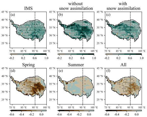
Snow assimilation over the Tibetan Plateau (TP) may influence seasonal forecasts over this region. To investigate the impacts of snow assimilation on the seasonal forecasts of snow, temperature and precipitation, twin ensemble reforecasts are initialized with and without snow assimilation above 1500 m altitude over the TP for spring and summer in 2018. The results show that snow assimilation can improve seasonal forecasts over the TP through the interaction between land and atmosphere.
Arsène Druel, Simon Munier, Anthony Mucia, Clément Albergel, and Jean-Christophe Calvet
Geosci. Model Dev., 15, 8453–8471, https://doi.org/10.5194/gmd-15-8453-2022, https://doi.org/10.5194/gmd-15-8453-2022, 2022
Short summary
Short summary
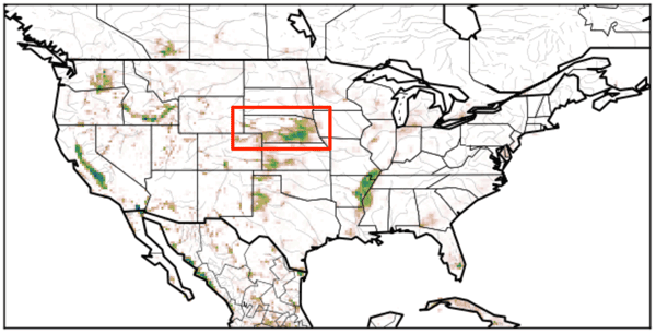
Crop phenology and irrigation is implemented into a land surface model able to work at a global scale. A case study is presented over Nebraska (USA). Simulations with and without the new scheme are compared to different satellite-based observations. The model is able to produce a realistic yearly irrigation water amount. The irrigation scheme improves the simulated leaf area index, gross primary productivity, evapotransipiration, and land surface temperature.
Sebastien Garrigues, Samuel Remy, Julien Chimot, Melanie Ades, Antje Inness, Johannes Flemming, Zak Kipling, Istvan Laszlo, Angela Benedetti, Roberto Ribas, Soheila Jafariserajehlou, Bertrand Fougnie, Shobha Kondragunta, Richard Engelen, Vincent-Henri Peuch, Mark Parrington, Nicolas Bousserez, Margarita Vazquez Navarro, and Anna Agusti-Panareda
Atmos. Chem. Phys., 22, 14657–14692, https://doi.org/10.5194/acp-22-14657-2022, https://doi.org/10.5194/acp-22-14657-2022, 2022
Short summary
Short summary
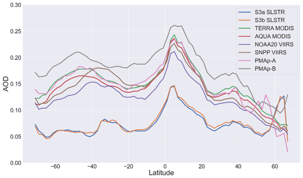
The Copernicus Atmosphere Monitoring Service (CAMS) provides global monitoring of aerosols using the ECMWF forecast model constrained by the assimilation of satellite aerosol optical depth (AOD). This work aims at evaluating two new satellite AODs to enhance the CAMS aerosol global forecast. It highlights the spatial and temporal differences between the satellite AOD products at the model spatial resolution, which is essential information to design multi-satellite AOD data assimilation schemes.
Anthony Mucia, Bertrand Bonan, Clément Albergel, Yongjun Zheng, and Jean-Christophe Calvet
Biogeosciences, 19, 2557–2581, https://doi.org/10.5194/bg-19-2557-2022, https://doi.org/10.5194/bg-19-2557-2022, 2022
Short summary
Short summary
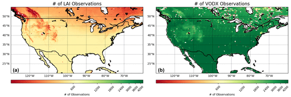
For the first time, microwave vegetation optical depth data are assimilated in a land surface model in order to analyze leaf area index and root zone soil moisture. The advantage of microwave products is the higher observation frequency. A large variety of independent datasets are used to verify the added value of the assimilation. It is shown that the assimilation is able to improve the representation of soil moisture, vegetation conditions, and terrestrial water and carbon fluxes.
Marine Remaud, Frédéric Chevallier, Fabienne Maignan, Sauveur Belviso, Antoine Berchet, Alexandra Parouffe, Camille Abadie, Cédric Bacour, Sinikka Lennartz, and Philippe Peylin
Atmos. Chem. Phys., 22, 2525–2552, https://doi.org/10.5194/acp-22-2525-2022, https://doi.org/10.5194/acp-22-2525-2022, 2022
Short summary
Short summary
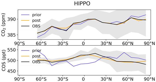
Carbonyl sulfide (COS) has been recognized as a promising indicator of the plant gross primary production (GPP). Here, we assimilate both COS and CO2 measurements into an atmospheric transport model to obtain information on GPP, plant respiration and COS budget. A possible scenario for the period 2008–2019 leads to a global COS biospheric sink of 800 GgS yr−1 and higher oceanic emissions between 400 and 600 GgS yr−1.
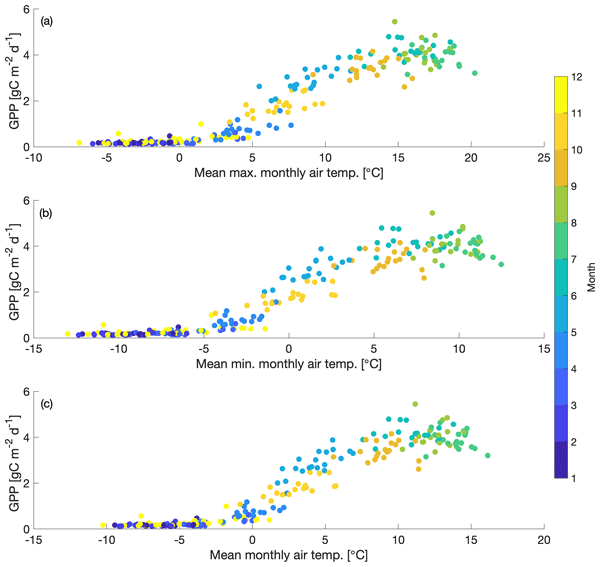
Stephanie G. Stettz, Nicholas C. Parazoo, A. Anthony Bloom, Peter D. Blanken, David R. Bowling, Sean P. Burns, Cédric Bacour, Fabienne Maignan, Brett Raczka, Alexander J. Norton, Ian Baker, Mathew Williams, Mingjie Shi, Yongguang Zhang, and Bo Qiu
Biogeosciences, 19, 541–558, https://doi.org/10.5194/bg-19-541-2022, https://doi.org/10.5194/bg-19-541-2022, 2022
Short summary
Short summary
Uncertainty in the response of photosynthesis to temperature poses a major challenge to predicting the response of forests to climate change. In this paper, we study how photosynthesis in a mountainous evergreen forest is limited by temperature. This study highlights that cold temperature is a key factor that controls spring photosynthesis. Including the cold-temperature limitation in an ecosystem model improved its ability to simulate spring photosynthesis.
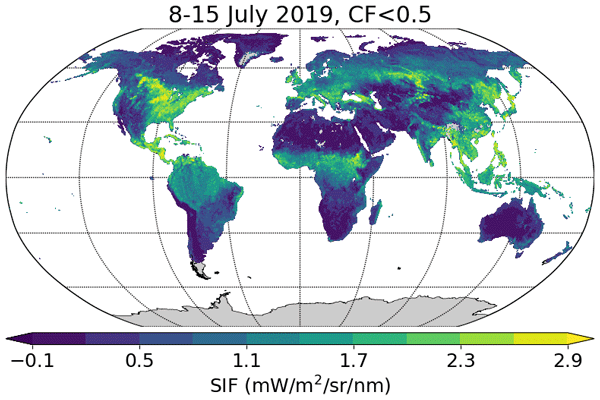
Luis Guanter, Cédric Bacour, Andreas Schneider, Ilse Aben, Tim A. van Kempen, Fabienne Maignan, Christian Retscher, Philipp Köhler, Christian Frankenberg, Joanna Joiner, and Yongguang Zhang
Earth Syst. Sci. Data, 13, 5423–5440, https://doi.org/10.5194/essd-13-5423-2021, https://doi.org/10.5194/essd-13-5423-2021, 2021
Short summary
Short summary
Sun-induced chlorophyll fluorescence (SIF) is an electromagnetic signal emitted by plants in the red and far-red parts of the spectrum. It has a functional link to photosynthesis and can be measured by satellite instruments, which makes it an important variable for the remote monitoring of the photosynthetic activity of vegetation ecosystems around the world. In this contribution we present a SIF dataset derived from the new Sentinel-5P TROPOMI missions.
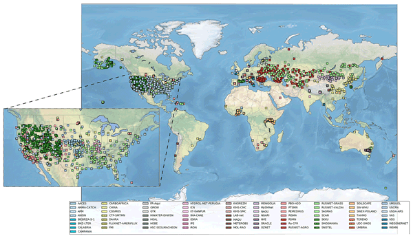
Wouter Dorigo, Irene Himmelbauer, Daniel Aberer, Lukas Schremmer, Ivana Petrakovic, Luca Zappa, Wolfgang Preimesberger, Angelika Xaver, Frank Annor, Jonas Ardö, Dennis Baldocchi, Marco Bitelli, Günter Blöschl, Heye Bogena, Luca Brocca, Jean-Christophe Calvet, J. Julio Camarero, Giorgio Capello, Minha Choi, Michael C. Cosh, Nick van de Giesen, Istvan Hajdu, Jaakko Ikonen, Karsten H. Jensen, Kasturi Devi Kanniah, Ileen de Kat, Gottfried Kirchengast, Pankaj Kumar Rai, Jenni Kyrouac, Kristine Larson, Suxia Liu, Alexander Loew, Mahta Moghaddam, José Martínez Fernández, Cristian Mattar Bader, Renato Morbidelli, Jan P. Musial, Elise Osenga, Michael A. Palecki, Thierry Pellarin, George P. Petropoulos, Isabella Pfeil, Jarrett Powers, Alan Robock, Christoph Rüdiger, Udo Rummel, Michael Strobel, Zhongbo Su, Ryan Sullivan, Torbern Tagesson, Andrej Varlagin, Mariette Vreugdenhil, Jeffrey Walker, Jun Wen, Fred Wenger, Jean Pierre Wigneron, Mel Woods, Kun Yang, Yijian Zeng, Xiang Zhang, Marek Zreda, Stephan Dietrich, Alexander Gruber, Peter van Oevelen, Wolfgang Wagner, Klaus Scipal, Matthias Drusch, and Roberto Sabia
Hydrol. Earth Syst. Sci., 25, 5749–5804, https://doi.org/10.5194/hess-25-5749-2021, https://doi.org/10.5194/hess-25-5749-2021, 2021
Short summary
Short summary
The International Soil Moisture Network (ISMN) is a community-based open-access data portal for soil water measurements taken at the ground and is accessible at https://ismn.earth. Over 1000 scientific publications and thousands of users have made use of the ISMN. The scope of this paper is to inform readers about the data and functionality of the ISMN and to provide a review of the scientific progress facilitated through the ISMN with the scope to shape future research and operations.
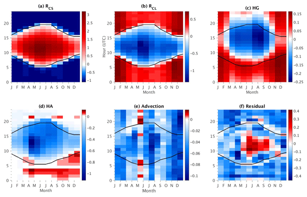
Oscar Javier Rojas Muñoz, Marjolaine Chiriaco, Sophie Bastin, and Justine Ringard
Atmos. Chem. Phys., 21, 15699–15723, https://doi.org/10.5194/acp-21-15699-2021, https://doi.org/10.5194/acp-21-15699-2021, 2021
Short summary
Short summary
A method is developed and evaluated to quantify each process that affects hourly 2 m temperature variations on a local scale, based almost exclusively on observations retrieved from an observatory near the Paris region. Each term involved in surface temperature variations is estimated, and its contribution and importance are also assessed. It is found that clouds are the main modulator on hourly temperature variations for most hours of the day, and thus their characterization is addressed.
Cited articles
Agustí-Panareda, A., McNorton, J., Balsamo, G., Baier, B. C., Bousserez, N., Boussetta, S., Brunner, D., Chevallier, F., Choulga, M., Diamantakis, M., Engelen, R., Flemming, J., Granier, C., Guevara, M., Denier van der Gon, H., Elguindi, N., Haussaire, J.-M., Jung, M., Janssens-Maenhout, G., Kivi, R., Massart, S., Papale, D., Parrington, M., Razinger, M., Sweeney, C., Vermeulen, A., and Walther, S.: Global nature run data with realistic high-resolution carbon weather for the year of the Paris agreement, Scientific Data, 9, 160, https://doi.org/10.1038/s41597-022-01228-2, 2022. a
Albergel, C., Calvet, J.-C., Mahfouf, J.-F., Rüdiger, C., Barbu, A. L., Lafont, S., Roujean, J.-L., Walker, J. P., Crapeau, M., and Wigneron, J.-P.: Monitoring of water and carbon fluxes using a land data assimilation system: a case study for southwestern France, Hydrol. Earth Syst. Sci., 14, 1109–1124, https://doi.org/10.5194/hess-14-1109-2010, 2010. a, b
Albergel, C., Munier, S., Leroux, D. J., Dewaele, H., Fairbairn, D., Barbu, A. L., Gelati, E., Dorigo, W., Faroux, S., Meurey, C., Le Moigne, P., Decharme, B., Mahfouf, J.-F., and Calvet, J.-C.: Sequential assimilation of satellite-derived vegetation and soil moisture products using SURFEX_v8.0: LDAS-Monde assessment over the Euro-Mediterranean area, Geosci. Model Dev., 10, 3889–3912, https://doi.org/10.5194/gmd-10-3889-2017, 2017. a, b
Albergel, C., Zheng, Y., Bonan, B., Dutra, E., Rodríguez-Fernández, N., Munier, S., Draper, C., de Rosnay, P., Muñoz-Sabater, J., Balsamo, G., Fairbairn, D., Meurey, C., and Calvet, J.-C.: Data assimilation for continuous global assessment of severe conditions over terrestrial surfaces, Hydrol. Earth Syst. Sci., 24, 4291–4316, https://doi.org/10.5194/hess-24-4291-2020, 2020. a, b
Bacour, C., Maignan, F., MacBean, N., Porcar-Castell, A., Flexas, J., Frankenberg, C., Peylin, P., Chevallier, F., Vuichard, N., and Bastrikov, V.: Improving Estimates of Gross Primary Productivity by Assimilating Solar-Induced Fluorescence Satellite Retrievals in a Terrestrial Biosphere Model Using a Process-Based SIF Model, J. Geophys. Res.- Biogeo., 124, 3281–3306, https://doi.org/10.1029/2019JG005040, 2019. a
Barbu, A. L., Calvet, J.-C., Mahfouf, J.-F., Albergel, C., and Lafont, S.: Assimilation of Soil Wetness Index and Leaf Area Index into the ISBA-A-gs land surface model: grassland case study, Biogeosciences, 8, 1971–1986, https://doi.org/10.5194/bg-8-1971-2011, 2011. a, b, c
Baret, F., Weiss, M., Lacaze, R., Camacho, F., Makhmara, H., Pacholcyzk, P., and Smets, B.: GEOV1: LAI and FAPAR essential climate variables and FCOVER global time series capitalizing over existing products. Part1: Principles of development and production, Remote Sens. Environ., 137, 299–309, https://doi.org/10.1016/j.rse.2012.12.027, 2013. a
Berry, J.: 3.10 solar induced chlorophyll fluorescence: Origins, relation to photosynthesis and retrieval, Compr. Remote Sens, 3, 143–162, 2018. a
Bolhar-Nordenkampf, H. R., Long, S. P., Baker, N. R., Oquist, G., Schreiber, U., and Lechner, E. G.: Chlorophyll Fluorescence as a Probe of the Photosynthetic Competence of Leaves in the Field: A Review of Current Instrumentation, Funct. Ecol., 3, 497–514, https://doi.org/10.2307/2389624, 1989. a
Bonan, B., Albergel, C., Zheng, Y., Barbu, A. L., Fairbairn, D., Munier, S., and Calvet, J.-C.: An ensemble square root filter for the joint assimilation of surface soil moisture and leaf area index within the Land Data Assimilation System LDAS-Monde: application over the Euro-Mediterranean region, Hydrol. Earth Syst. Sci., 24, 325–347, https://doi.org/10.5194/hess-24-325-2020, 2020. a, b
Butterfield, Z., Magney, T., Grossmann, K., Bohrer, G., Vogel, C., Barr, S., and Keppel-Aleks, G.: Accounting for changes in radiation improves the ability of SIF to track water stress-induced losses in summer GPP in a temperate deciduous forest, J. Geophys. Res.-Biogeo., 128, e2022JG007352, https://doi.org/10.1029/2022JG007352, 2023. a
Calvet, J.-C.: Investigating soil and atmospheric plant water stress using physiological and micrometeorological data, Agr. Forest Meteorol., 103, 229–247, 2000. a
Calvet, J.-C. and Champeaux, J.-L.: L'apport de la télédétection spatiale à la modélisation des surfaces continentales, La Météorologie, 108, 52–58, https://doi.org/10.37053/lameteorologie-2020-0016, 2020. a
Calvet, J.-C., Noilhan, J., Roujean, J.-L., Bessemoulin, P., Cabelguenne, M., Olioso, A., and Wigneron, J.-P.: An interactive vegetation SVAT model tested against data from six contrasting sites, Agr. Forest Meteorol., 92, 73–95, 1998. a
Calvet, J.-C., Rivalland, V., Picon-Cochard, C., and Guehl, J.-M.: Modelling forest transpiration and CO2 fluxes – Response to soil moisture stress, Agr. Forest Meteorol., 124, 143–156, 2004. a
Corchia, T., Bonan, B., Rodríguez-Fernández, N., Colas, G., and Calvet, J.-C.: Assimilation of ASCAT Radar Backscatter Coefficients over Southwestern France, Remote Sens., 15, 4258, https://doi.org/10.3390/rs15174258, 2023. a, b, c
De Rosnay, P., Drusch, M., Vasiljevic, D., Balsamo, G., Albergel, C., and Isaksen, L.: A simplified extended Kalman filter for the global operational soil moisture analysis at ECMWF, Q. J. Roy. Meteor. Soc., 139, 1199–1213, 2013. a
Decharme, B., Boone, A., Delire, C., and Noilhan, J.: Local evaluation of the Interaction between Soil Biosphere Atmosphere soil multilayer diffusion scheme using four pedotransfer functions, J. Geophys. Res.-Atmos., 116, https://doi.org/10.1029/2011JD016002, 2011. a
Decharme, B., Martin, E., and Faroux, S.: Reconciling soil thermal and hydrological lower boundary conditions in land surface models, J. Geophys. Res.-Atmos., 118, 7819–7834, 2013. a
Fairbairn, D., Barbu, A. L., Napoly, A., Albergel, C., Mahfouf, J.-F., and Calvet, J.-C.: The effect of satellite-derived surface soil moisture and leaf area index land data assimilation on streamflow simulations over France, Hydrol. Earth Syst. Sci., 21, 2015–2033, https://doi.org/10.5194/hess-21-2015-2017, 2017. a
Faroux, S., Kaptué Tchuenté, A. T., Roujean, J.-L., Masson, V., Martin, E., and Le Moigne, P.: ECOCLIMAP-II/Europe: a twofold database of ecosystems and surface parameters at 1 km resolution based on satellite information for use in land surface, meteorological and climate models, Geosci. Model Dev., 6, 563–582, https://doi.org/10.5194/gmd-6-563-2013, 2013. a
Friedl, M. and Sulla-Menashe, D.: MODIS/Terra+Aqua Land Cover Type Yearly L3 Global 0.05Deg CMG. NASA LP DAAC, Tech. rep., Boston University and MODAPS SIPS, NASA, https://doi.org/10.5067/MODIS/MCD12C1.006, 2015. a
Friedlingstein, P., O'Sullivan, M., Jones, M. W., Andrew, R. M., Hauck, J., Landschützer, P., Le Quéré, C., Li, H., Luijkx, I. T., Olsen, A., Peters, G. P., Peters, W., Pongratz, J., Schwingshackl, C., Sitch, S., Canadell, J. G., Ciais, P., Jackson, R. B., Alin, S. R., Arneth, A., Arora, V., Bates, N. R., Becker, M., Bellouin, N., Berghoff, C. F., Bittig, H. C., Bopp, L., Cadule, P., Campbell, K., Chamberlain, M. A., Chandra, N., Chevallier, F., Chini, L. P., Colligan, T., Decayeux, J., Djeutchouang, L. M., Dou, X., Duran Rojas, C., Enyo, K., Evans, W., Fay, A. R., Feely, R. A., Ford, D. J., Foster, A., Gasser, T., Gehlen, M., Gkritzalis, T., Grassi, G., Gregor, L., Gruber, N., Gürses, Ö., Harris, I., Hefner, M., Heinke, J., Hurtt, G. C., Iida, Y., Ilyina, T., Jacobson, A. R., Jain, A. K., Jarníková, T., Jersild, A., Jiang, F., Jin, Z., Kato, E., Keeling, R. F., Klein Goldewijk, K., Knauer, J., Korsbakken, J. I., Lan, X., Lauvset, S. K., Lefèvre, N., Liu, Z., Liu, J., Ma, L., Maksyutov, S., Marland, G., Mayot, N., McGuire, P. C., Metzl, N., Monacci, N. M., Morgan, E. J., Nakaoka, S.-I., Neill, C., Niwa, Y., Nützel, T., Olivier, L., Ono, T., Palmer, P. I., Pierrot, D., Qin, Z., Resplandy, L., Roobaert, A., Rosan, T. M., Rödenbeck, C., Schwinger, J., Smallman, T. L., Smith, S. M., Sospedra-Alfonso, R., Steinhoff, T., Sun, Q., Sutton, A. J., Séférian, R., Takao, S., Tatebe, H., Tian, H., Tilbrook, B., Torres, O., Tourigny, E., Tsujino, H., Tubiello, F., van der Werf, G., Wanninkhof, R., Wang, X., Yang, D., Yang, X., Yu, Z., Yuan, W., Yue, X., Zaehle, S., Zeng, N., and Zeng, J.: Global Carbon Budget 2024, Earth Syst. Sci. Data, 17, 965–1039, https://doi.org/10.5194/essd-17-965-2025, 2025. a
Garrigues, S., de Rosnay, P., Weston, P., Rüdiger, C., Bacour, C., Fairbairn, D., Vanderbecken, P., Rojas-Munoz, O., Pinnington, E., Agusti-Panareda, A., Boussetta, S., Calvet, J.-C., and Engelen, R.: Assimilation of solar-induced fluorescence satellite observations in the European Centre for Medium-Range Weather Forecasts integrated forecast system, Q. J. Roy. Meteor. Soc., 152, e70111, https://doi.org/10.1002/qj.70111, 2026. a, b, c
Gibelin, A.-L., Calvet, J.-C., Roujean, J.-L., Jarlan, L., and Los, S. O.: Ability of the land surface model ISBA-A-gs to simulate leaf area index at the global scale: Comparison with satellites products, J. Geophys. Res.-Atmos., 111, https://doi.org/10.1029/2005JD006691, 2006. a
Guanter, L., Aben, I., Tol, P., Krijger, J. M., Hollstein, A., Köhler, P., Damm, A., Joiner, J., Frankenberg, C., and Landgraf, J.: Potential of the TROPOspheric Monitoring Instrument (TROPOMI) onboard the Sentinel-5 Precursor for the monitoring of terrestrial chlorophyll fluorescence, Atmos. Meas. Tech., 8, 1337–1352, https://doi.org/10.5194/amt-8-1337-2015, 2015. a
Guanter, L., Bacour, C., Schneider, A., Aben, I., van Kempen, T. A., Maignan, F., Retscher, C., Köhler, P., Frankenberg, C., Joiner, J., and Zhang, Y.: The TROPOSIF global sun-induced fluorescence dataset from the Sentinel-5P TROPOMI mission, Earth Syst. Sci. Data, 13, 5423–5440, https://doi.org/10.5194/essd-13-5423-2021, 2021. a, b
Hamer, P. D., Markelj, M., Rojas-Munoz, O., Bonan, B., Calvet, J.-C., Marécal, V., Guenther, A., Trimmel, H., Vallejo, I., Eckhardt, S., Sousa Santos, G., Sindelarova, K., Simpson, D., Schmidbauer, N., Hellén, H., Rubli, P., Reimann, S., Claude, A., Kubistin, D., Cozic, J., Dernie, J., and Tarrasón, L.: Two biogenic volatile organic compound emission datasets over Europe based on land surface modelling and satellite data assimilation, Earth Syst. Sci. Data, 18, 3635–3669, https://doi.org/10.5194/essd-18-3635-2026, 2026. a, b
Horowitz, C. A.: Paris Agreement, International Legal Materials, Cambridge University Press, 55, 740–755, https://doi.org/10.1017/S0020782900004253, 2016. a
Jacobs, C.: Direct impact of atmospheric CO2 enrichment on regional transpiration, internal phd, wU thesis 1772 Proefschrift Wageningen, Netherlands, ISBN 9789054852506, https://doi.org/10.18174/206972, 1994. a
Jacobs, C., Van den Hurk, B., and De Bruin, H.: Stomatal behaviour and photosynthetic rate of unstressed grapevines in semi-arid conditions, Agr. Forest Meteorol., 80, 111–134, 1996. a
Jarlan, L., Albergel, C., Bonan, B., Calvet, J.-C., De Rosnay, P., Ottlé, C., and Peylin, P.: Assimilation de données de télédétection pour le suivi des surfaces continentales, in: Inversion et assimilation de données de télédétection: Estimation des paramètres géophysiques, edited by: Yan, Y., ISTE, 45–95, https://doi.org/10.51926/ISTE.9142.ch2, 2023. a
Joiner, J., Yoshida, Y., Guanter, L., and Middleton, E. M.: New methods for the retrieval of chlorophyll red fluorescence from hyperspectral satellite instruments: simulations and application to GOME-2 and SCIAMACHY, Atmos. Meas. Tech., 9, 3939–3967, https://doi.org/10.5194/amt-9-3939-2016, 2016. a
Jung, M., Schwalm, C., Migliavacca, M., Walther, S., Camps-Valls, G., Koirala, S., Anthoni, P., Besnard, S., Bodesheim, P., Carvalhais, N., Chevallier, F., Gans, F., Goll, D. S., Haverd, V., Köhler, P., Ichii, K., Jain, A. K., Liu, J., Lombardozzi, D., Nabel, J. E. M. S., Nelson, J. A., O'Sullivan, M., Pallandt, M., Papale, D., Peters, W., Pongratz, J., Rödenbeck, C., Sitch, S., Tramontana, G., Walker, A., Weber, U., and Reichstein, M.: Scaling carbon fluxes from eddy covariance sites to globe: synthesis and evaluation of the FLUXCOM approach, Biogeosciences, 17, 1343–1365, https://doi.org/10.5194/bg-17-1343-2020, 2020. a
Köhler, P., Guanter, L., and Joiner, J.: A linear method for the retrieval of sun-induced chlorophyll fluorescence from GOME-2 and SCIAMACHY data, Atmos. Meas. Tech., 8, 2589–2608, https://doi.org/10.5194/amt-8-2589-2015, 2015. a
Köhler, P., Frankenberg, C., Magney, T. S., Guanter, L., Joiner, J., and Landgraf, J.: Global Retrievals of Solar-Induced Chlorophyll Fluorescence With TROPOMI: First Results and Intersensor Comparison to OCO-2, Geophys. Res. Lett., 45, 10456–10463, https://doi.org/10.1029/2018GL079031, 2018. a, b
Leroux, D. J., Calvet, J.-C., Munier, S., and Albergel, C.: Using Satellite-Derived Vegetation Products to Evaluate LDAS-Monde over the Euro-Mediterranean Area, Remote Sens., 10, https://doi.org/10.3390/rs10081199, 2018. a
LOBELIA: Revealing emission sources from space, Zenodo, https://doi.org/10.5281/zenodo.10837172, 2024. a
Lunel, T., Boone, A. A., and Le Moigne, P.: Irrigation strongly influences near-surface conditions and induces breeze circulation: Observational and model-based evidence, Q. J. Roy. Meteor. Soc., 150, https://doi.org/10.1002/qj.4736, 2024. a
Mahfouf, J.-F. and Bilodeau, B.: A simple strategy for linearizing complex moist convective schemes, Q. J. Roy. Meteor. Soc., 135, 953–962, https://doi.org/10.1002/qj.427, 2009. a
Mahfouf, J.-F., Bergaoui, K., Draper, C., Bouyssel, F., Taillefer, F., and Taseva, L.: A comparison of two off-line soil analysis schemes for assimilation of screen level observations, J. Geophys. Res.-Atmos., 114, https://doi.org/10.1029/2008JD011077, 2009. a
Masson, V., Le Moigne, P., Martin, E., Faroux, S., Alias, A., Alkama, R., Belamari, S., Barbu, A., Boone, A., Bouyssel, F., Brousseau, P., Brun, E., Calvet, J.-C., Carrer, D., Decharme, B., Delire, C., Donier, S., Essaouini, K., Gibelin, A.-L., Giordani, H., Habets, F., Jidane, M., Kerdraon, G., Kourzeneva, E., Lafaysse, M., Lafont, S., Lebeaupin Brossier, C., Lemonsu, A., Mahfouf, J.-F., Marguinaud, P., Mokhtari, M., Morin, S., Pigeon, G., Salgado, R., Seity, Y., Taillefer, F., Tanguy, G., Tulet, P., Vincendon, B., Vionnet, V., and Voldoire, A.: The SURFEXv7.2 land and ocean surface platform for coupled or offline simulation of earth surface variables and fluxes, Geosci. Model Dev., 6, 929–960, https://doi.org/10.5194/gmd-6-929-2013, 2013. a, b
Moya, I., Camenen, L., Evain, S., Goulas, Y., Cerovic, Z., Latouche, G., Flexas, J., and Ounis, A.: A new instrument for passive remote sensing: 1. Measurements of sunlight-induced chlorophyll fluorescence, Remote Sens. Environ., 91, 186–197, https://doi.org/10.1016/j.rse.2004.02.012, 2004. a
Nelson, J. A., Walther, S., Gans, F., Kraft, B., Weber, U., Novick, K., Buchmann, N., Migliavacca, M., Wohlfahrt, G., Šigut, L., Ibrom, A., Papale, D., Göckede, M., Duveiller, G., Knohl, A., Hörtnagl, L., Scott, R. L., Dušek, J., Zhang, W., Hamdi, Z. M., Reichstein, M., Aranda-Barranco, S., Ardö, J., Op de Beeck, M., Billesbach, D., Bowling, D., Bracho, R., Brümmer, C., Camps-Valls, G., Chen, S., Cleverly, J. R., Desai, A., Dong, G., El-Madany, T. S., Euskirchen, E. S., Feigenwinter, I., Galvagno, M., Gerosa, G. A., Gielen, B., Goded, I., Goslee, S., Gough, C. M., Heinesch, B., Ichii, K., Jackowicz-Korczynski, M. A., Klosterhalfen, A., Knox, S., Kobayashi, H., Kohonen, K.-M., Korkiakoski, M., Mammarella, I., Gharun, M., Marzuoli, R., Matamala, R., Metzger, S., Montagnani, L., Nicolini, G., O'Halloran, T., Ourcival, J.-M., Peichl, M., Pendall, E., Ruiz Reverter, B., Roland, M., Sabbatini, S., Sachs, T., Schmidt, M., Schwalm, C. R., Shekhar, A., Silberstein, R., Silveira, M. L., Spano, D., Tagesson, T., Tramontana, G., Trotta, C., Turco, F., Vesala, T., Vincke, C., Vitale, D., Vivoni, E. R., Wang, Y., Woodgate, W., Yepez, E. A., Zhang, J., Zona, D., and Jung, M.: X-BASE: the first terrestrial carbon and water flux products from an extended data-driven scaling framework, FLUXCOM-X, Biogeosciences, 21, 5079–5115, https://doi.org/10.5194/bg-21-5079-2024, 2024. a
Noilhan, J. and Mahfouf, J.-F.: The ISBA land surface parameterisation scheme, Global Planet. Change, 13, 145–159, https://doi.org/10.1016/0921-8181(95)00043-7, 1996. a
Noilhan, J. and Planton, S.: A Simple Parameterization of Land Surface Processes for Meteorological Models, Mon. Weather Rev., 117, 536–549, https://doi.org/10.1175/1520-0493(1989)117<0536:ASPOLS>2.0.CO;2, 1989. a
Rascher, U., Alonso, L., Burkart, A., Cilia, C., Cogliati, S., Colombo, R., Damm, A., Drusch, M., Guanter, L., Hanus, J., Hyvärinen, T., Julitta, T., Jussila, J., Kataja, K., Kokkalis, P., Kraft, S., Kraska, T., Matveeva, M., Moreno, J., Muller, O., Panigada, C., Pikl, M., Pinto, F., Prey, L., Pude, R., Rossini, M., Schickling, A., Schurr, U., Schüttemeyer, D., Verrelst, J., and Zemek, F.: Sun-induced fluorescence – a new probe of photosynthesis: First maps from the imaging spectrometer HyPlant, Glob. Change Biol., 21, 4673–4684, https://doi.org/10.1111/gcb.13017, 2015. a
Ricart, S., Ribas, A., and Pavón, D.: Qualifying irrigation system sustainability by means of stakeholder perceptions and concerns: lessons from the Segarra-Garrigues Canal, Spain, Nat. Resour. Forum, 40, 77–90, https://doi.org/10.1111/1477-8947.12097, 2016. a
Richards, L. A.: Capillary conduction of liquids through porous mediums, Physics, 1, 318–333, 1931. a
Rüdiger, C., Albergel, C., Mahfouf, J.-F., Calvet, J.-C., and Walker, J. P.: Evaluation of the observation operator Jacobian for leaf area index data assimilation with an extended Kalman filter, J. Geophys. Res.-Atmos., 115, https://doi.org/10.1029/2009JD012912, 2010. a
Sabater, J. M., Rüdiger, C., Calvet, J.-C., Fritz, N., Jarlan, L., and Kerr, Y.: Joint assimilation of surface soil moisture and LAI observations into a land surface model, Agr. Forest Meteorol., 148, 1362–1373, https://doi.org/10.1016/j.agrformet.2008.04.003, 2008. a
Trimmel, H., Hamer, P., Mayer, M., Schreier, S. F., Weihs, P., Eitzinger, J., Sandén, H., Fitzky, A. C., Richter, A., Calvet, J.-C., Bonan, B., Meurey, C., Vallejo, I., Eckhardt, S., Santos, G. S., Oumami, S., Arteta, J., Marécal, V., Tarrasón, L., Karl, T., and Rieder, H. E.: The influence of vegetation drought stress on formaldehyde and ozone distributions over a central European city, Atmos. Environ., 304, 119768, https://doi.org/10.1016/j.atmosenv.2023.119768, 2023. a
Vanderbecken, P. J.: WP4 – supplementary data – Using deep learning to assimilate sun-induced fluorescence satellite observations in the ISBA land surface model: Datasets, Zenodo [data set], https://doi.org/10.5281/zenodo.18668100, 2026a. a
Vanderbecken, P. J.: WP4 – supplementary data – Using deep learning to assimilate sun-induced fluorescence satellite observations in the ISBA land surface model: model, Zenodo [code], https://doi.org/10.5281/zenodo.18669437, 2026b. a
Veefkind, J., Aben, I., McMullan, K., Förster, H., de Vries, J., Otter, G., Claas, J., Eskes, H., de Haan, J., Kleipool, Q., van Weele, M., Hasekamp, O., Hoogeveen, R., Landgraf, J., Snel, R., Tol, P., Ingmann, P., Voors, R., Kruizinga, B., Vink, R., Visser, H., and Levelt, P.: TROPOMI on the ESA Sentinel-5 Precursor: A GMES mission for global observations of the atmospheric composition for climate, air quality and ozone layer applications, Remote Sens. Environ., 120, 70–83, https://doi.org/10.1016/j.rse.2011.09.027, 2012. a
Short summary
New satellite observations are used to improve our understanding of regional-scale vegetation. Innovative artificial intelligence methods are employed to combine the available information. The effectiveness of this approach is evaluated using independent observations. The results show that agricultural practices such as irrigation can be modelled more accurately.
New satellite observations are used to improve our understanding of regional-scale vegetation....


Altmetrics
Final-revised paper
Preprint